- This topic is empty.
-
AuthorPosts
-
18/11/2026 at 00:00 #13199
Gold mineralization rarely announces itself at the surface. Depending on the deposit type, exploration teams can use electrical resistivity, induced polarization (IP), and transient electromagnetic (TEM) surveys to identify subsurface contrasts and narrow down targets for follow-up. Geological mapping, sampling, and assays help establish whether those targets contain gold mineralization, with drilling used where appropriate to test buried targets.
Why Geophysical Methods Matter in Gold Exploration
Deep targets, poor electrode contact, and field noise can make reliable measurements difficult to obtain. Survey teams also have to reconcile geological observations, geophysical measurements, and drilling records that may be stored in different formats. Reviewing data while the survey line is still in place gives crews time to check questionable readings and repeat measurements before demobilizing.
Geomative Co., Ltd., operating under the brand Geomative, develops geophysical instruments and digital tools for subsurface investigation. Founded in 2011, the company reports serving customers in more than 50 countries and regions.
How Resistivity and IP Surveys Identify Gold Exploration Targets
Resistivity surveys map differences in how readily the ground conducts electricity. These contrasts can help trace rock contacts, structures, and alteration zones. IP measures how the ground polarizes in response to an applied electrical current. Some disseminated sulfides produce measurable IP responses, and clay-rich materials can also contribute. The local geology helps determine whether an anomaly warrants follow-up.
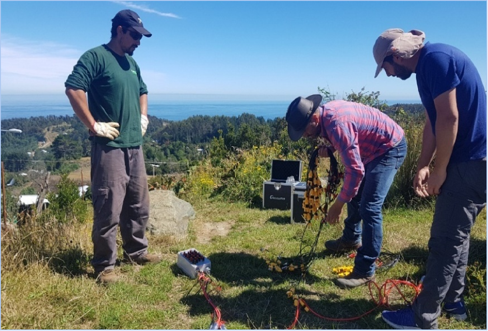
Geomative’s GD-10 is a modular, single-channel system for field resistivity and IP acquisition. It supports different electrode arrays and compatible roll-along layouts for extending survey lines. With the appropriate cables and accessories, the system can be configured for surface, tunnel, borehole, or underwater surveys.
The multichannel GD-20 and GD-22 support parallel acquisition in compatible arrays. The GD-22 has six receive channels, a maximum transmit rating of 15 kW, 24-bit A/D conversion, a 140 dB dynamic range, and selectable 50 Hz or 60 Hz power-line rejection rated at ≥120 dB. Its full-waveform recording gives crews more information to review when investigating questionable readings.
The GD-32 has twelve receive channels and a maximum transmit rating of 15 kW. The GD-12 has one receive channel and a maximum transmit rating of 7.2 kW. Compare the published ratings by model, then check the output the proposed power supply, cabling, and switching hardware can deliver under expected ground conditions.
Transient Electromagnetic Methods as a Complementary Approach
TEM measures the decay of the electromagnetic response after a transmitter pulse. It can complement resistivity and IP where the exploration model calls for mapping conductive targets or geological structures. Geomative’s GT-10 is a TEM system designed for mineral exploration. Useful investigation depth depends on the transmitter and receiver configuration, target size and conductivity, overburden, and field noise.
From Field Data to Interpreted Targets: The Role of Digital Platforms
Geomative’s DIGspace Geoscience Platform supports electrical resistivity tomography (ERT) inversion, desktop analysis, and web-based collaboration. Teams can compare supported ERT, ground-penetrating radar (GPR), and borehole logging datasets in a common 3D view. Check method support before planning a combined workflow, including which software will process the IP or TEM data.
For GD-10 survey data, Geomative Studio supports export in TXT, Excel, DAT, and URF formats. Check that the selected export preserves the measurement and electrode geometry information needed by the interpretation software.
What the Evidence Shows: A Brazil Gold Exploration Case
In Pará, Brazil, Geomative documented a high-density resistivity and IP survey using a GD-10 Supreme 2D+/3D+ configuration with 24 non-polarizing electrodes. The survey investigated electrical anomalies in an area considered prospective for mineralization. These anomalies can help prioritize follow-up locations for geological mapping, sampling, or drilling.
At the Beishan Lead-Zinc Mine in Hechi, Guangxi, Geomative used the GT-30 for underground mineral and groundwater investigation. The team interpreted TEM anomalies alongside site geology. Geomative reports that subsequent exposure agreed with the interpreted locations of the lead-zinc body and aquifer.
Choosing a Geophysical Approach for Gold Mineralization Detection
-
Start with the target’s expected physical properties. Consider resistivity for electrical contrasts, IP for chargeable materials, and TEM for conductive targets. Use the deposit model and host geology to decide which measurements will help distinguish the target from its surroundings.
-
Match the acquisition setup to the survey. Compare rated transmit output and receive-channel count by model. Estimate field performance using the planned array, target size and depth, overburden, electrode contact, and site noise.
-
Review data before leaving the field. Include time to check questionable readings and repeat measurements while the survey layout is still in place.
-
Plan interpretation and verification together. Check how each dataset will be processed and compared with geological observations. Use geophysical anomalies to prioritize follow-up locations, then use appropriate sampling, drilling, and assays to establish whether gold mineralization is present.
https://www.geomative.com/
Geomative Co., Ltd. -
-
AuthorPosts

- You must be logged in to reply to this topic.